
The Measure tool reports the distance and orientation between any two points in your scene. Both points are picked from real geometry, so the measurement is a true 3D measurement of your data rather than something read off the screen.
Using the Tool
Toggle the tool using the measure button on the status bar, or by pressing the M key. The button is shown brightened while the tool is waiting for you to pick points.

The status bar buttons are, from left to right: legend, measure, screenshot, graticule, perspective view and orthographic view.
To take a measurement:
- Left click the start point.
- Move the mouse. A green line follows the pointer and the measurement window updates live, so you can read values as you search for the point you want.
- Left click the end point. The line and its values are fixed, and the tool switches itself off.
Because the tool turns off after each measurement, normal left click selection is available again straight away without you having to remember to cancel the tool. Press M again for the next measurement.
Right click while the tool is active to cancel and clear the current line.
Points are only picked where the click hits something in the scene, such as a surface, drillhole, point, volume or asset. Clicking empty background does nothing, so a measurement always runs between two real positions on your data.
The measurement stays on screen after the tool switches off. Close the Measure window with the X in its title bar to remove the line from the scene.
The Measurements
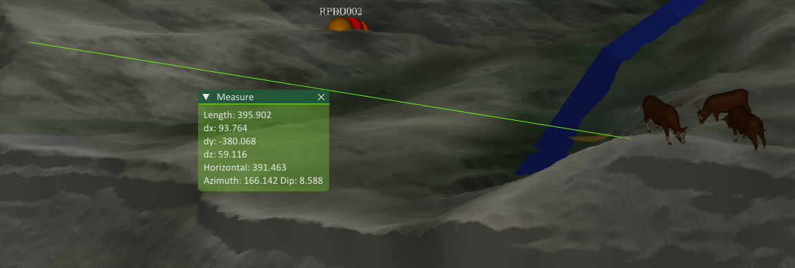
The green Measure window sits at the middle of the line and shows:
- Length — the straight line 3D distance between the two points, including the height difference.
- dx — the difference in easting, end point minus start point. Negative when the end point is to the west.
- dy — the difference in northing, end point minus start point. Negative when the end point is to the south.
- dz — the difference in elevation, end point minus start point. Negative when the end point is lower.
- Horizontal — the distance measured in plan, ignoring the height difference. This is the length you would get from a map.
- Azimuth — the horizontal bearing from the start point to the end point, in degrees clockwise from north, in the range 0 to 360.
- Dip — the inclination from the start point to the end point, in degrees from horizontal. Positive when the end point is above the start point and negative when it is below.
All distances are in the units of your project coordinate reference system, normally metres. Angles are always in degrees.
The direction sensitive values, dx, dy, dz, azimuth and dip, are all measured from the first point you clicked to the second. Clicking the same two points in the opposite order gives the same Length and Horizontal distance, but reverses the sign of the differences and the dip, and swings the azimuth by 180 degrees.