
A streaming image source drapes tiled imagery from a web service over a surface: base maps, satellite imagery, geology, or any other map served as tiles. Sources are defined once in the Configure dialog and can then be added to any surface from its Image Sources tab.
Supported protocols
- XYZ — Slippy-map tiles, the most common web tile format. The tile origin is in the top-left corner.
- TMS — OSGeo Tile Map Service. Like XYZ, but the tile row is counted from the bottom.
- WMTS — OGC Web Map Tile Service, requested either as RESTful paths or KVP GetTile requests.
- WMS — OGC Web Map Service. Unlike the others, a WMS server publishes a list of layers, and you choose which ones to combine and in what order (see below).
- QGIS Live Map — the live QGIS Desktop map, streamed from the Geoscience plugin. It has its own button and is described in QGIS Live Map.
Setting up a new source
Open the Configure dialog and choose the Streaming tab. Click Add New Server, then fill in the Server Details.
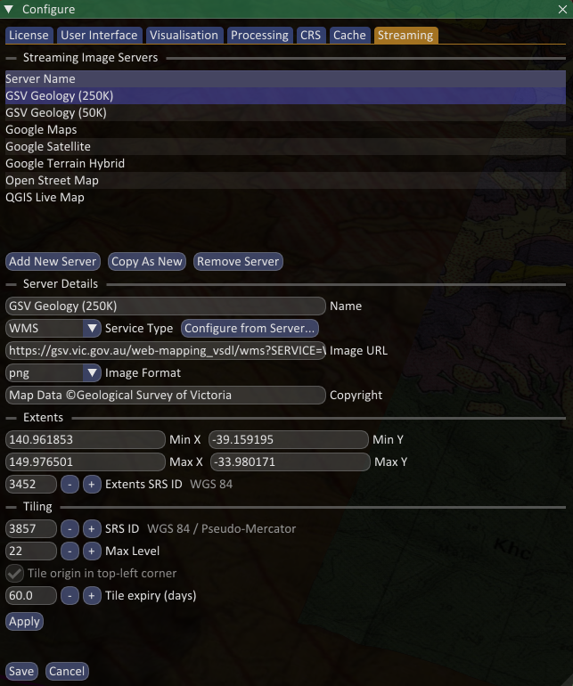
- Name — how the source appears in the list and on a surface.
- Service Type — pick the protocol above. This sets the tile origin to the convention for that service.
- Image URL — the tile URL template. XYZ and TMS use tokens such as
{z},{x},{y}(and{quadkey}); WMTS and WMS templates use their own tokens, filled in for you by the WMS helper below. - Extents, Tiling SRS and Max Level describe the area the service covers and the tile grid it uses. For a new server these default to the whole Web Mercator grid, which suits most global services.
Click Apply to keep your edits, then Save to store the source. Copy As New duplicates the selected source as a starting point, and Remove Server deletes it.
Configuring a WMS source
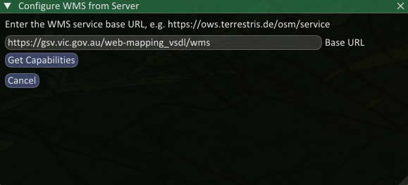
A WMS source only needs the server’s base address; the rest is discovered. Set the Service Type to WMS and click Configure from Server…. Enter the Base URL and click Get Capabilities.
Spatial Integration reads the server’s published layers and lists them. Tick the layers you want to combine, and drag them to reorder: the layer at the top of the list is drawn last, so it appears on top. Choose a CRS and Image Format, then click OK.
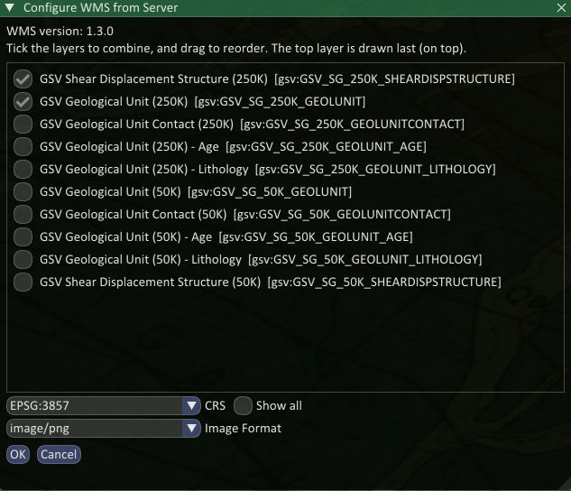
The Image URL, format, CRS and extents are then filled in from your selection.
How tiles are cached
Downloaded tiles are cached on disk so that revisiting an area does not re-download them. Each source has a Tile expiry (days) value: once a cached tile is older than this it is fetched again, so the imagery stays reasonably current without a manual refresh. The old tile is only replaced once the new one has actually downloaded, so nothing is lost if the server cannot be reached.
Reconfiguring a WMS source — changing its layers or CRS — clears that source’s cached tiles, because the cache is keyed on the source rather than on the request. Without this, the old tiles would keep showing the previous selection.
You can also manage the cache directly from the Cache tab of the Configure dialog, which lists each cached source with the disk space it uses. Select one and click Delete to clear it; the tiles are re-downloaded the next time that source is viewed.
When a server stops responding
Servers go down, and laptops go offline. When a source stops answering, Spatial Integration stops asking it for a while and draws that source from its cached tiles instead, so the rest of the project keeps working at full speed rather than waiting on requests that will not be answered. Areas you have not visited before will simply have no imagery for that source.
A warning icon appears beside the source in the layer flyout, and a message is written to the log. The source is not removed: it stays on the surface and is still saved with the project.
The server is retried automatically every half minute or so, and the source returns to normal as soon as it answers. To retry immediately, click the refresh button next to the warning icon.
QGIS Live Map
The QGIS Live Map is a special streaming source that follows your open QGIS project in real time. It is set up differently and is covered separately in QGIS Live Map.